Logo Istituto Nazionale di Geofisica e Vulcanologia

A compilation of potential sources for earthquakes larger than M 5.5 in Italy and surrounding areas

Logo DISS

Documentation

The "Database of Individual Seismogenic Sources" was conceived in the late '90s by a group of scientists of Istituto Nazionale di Geofisica e Vulcanologia. The Database has since been greatly improved through successive releases. Database updates are irregular and can be expected to appear approximately once in a few years. Users will be notified of any further versions through this website. Join our community to stay updated.

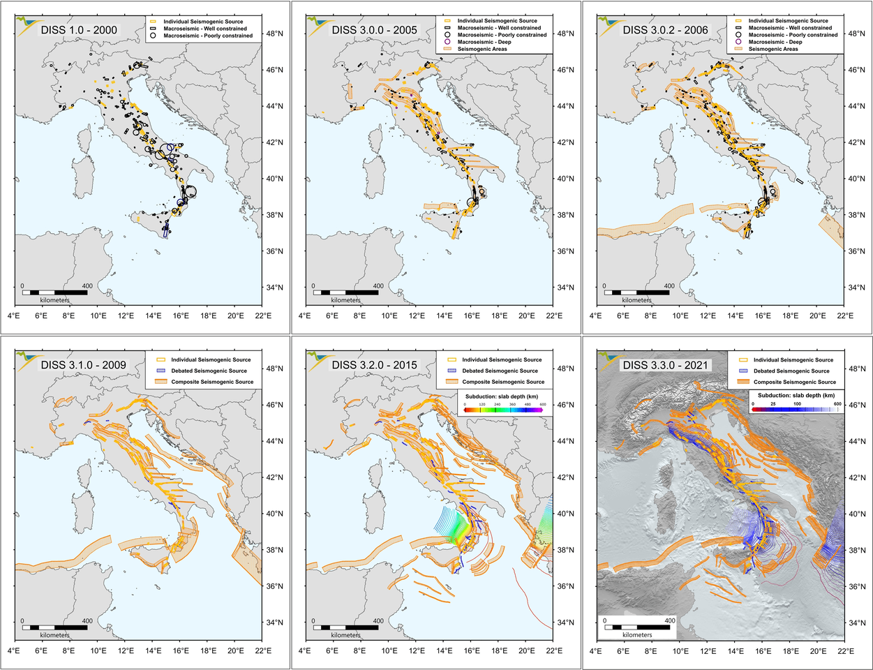
DISS changes over time

Image

DISS version 2

Image

December 2021

Version 3.3.0

(read more and download...). This version of DISS was completed in December 2021 as a planned update dedicated to the 2020 update of the European Seismic Hazard Model map of Europe (ESHM20).

December 2021

July 2018

Version 3.2.1

(read more and download...). This version of DISS was completed in early July 2016 as one of the input datasets of Italy’s Seismic Hazard Map MPS19. Its use was initially restricted to participants in the MPS19 program until the public release of the Database in April 2018.

2018

Joining EPOS Italia

The database is included as a service product of the EPOS Italia Joint Research Unit, a national initiative within the framework of EPOS ERIC supported by the Italian Ministry for University and Research.

2018

June 2015

Version 3.2.0

(read more and download...). Planned update.

2013

Release of the European Database of Seismogenic Faults

This database was one of the outcomes of SHARE (Seismic Hazard Harmonization in Europe), a research project funded by the European Community.

2013

July 2010

Version 3.1.1

(read more and download...) released as the final contribution to the project "Analysis of the seismic potential in Italy for the evaluation of the seismic hazard", funded by the Italian Department of Civil Protection.

June 2009

Version 3.1.0

(read more and download...) released as a contribution to the project "Analysis of the seismic potential in Italy for the evaluation of the seismic hazard", funded by the Italian Department of Civil Protection.

June 2009

July and October 2007

Version 3.0.3 and 3.0.4

(read more and download...) released as a contribution to the project "Assessing the seismogenic potential and the probability of large earthquakes in Italy", funded by the Italian Department of Civil Protection.

September 2006

Version 3.0.2

(read more and download...) released, which includes a substantial extension of the database to the Mediterranean area.

September 2006

April 2006

Version 3.0.1 goes on Google Earth®

DISS takes advantage of the free software Google Earth to facilitate its users and expand its capabilities in disseminating data.

November 2005

Version 3.0.1

(read more and download...), a stable version of the database both as a standalone application and as an online cartographic interface.

November 2005

May 2005

Version 3.0.0 released as a standalone application

a MapInfo® desktop GIS application that shares the same data and the same structure as its web counterpart.

January 2005

Version 3.0.0 released on the web

(read more and download...), an Internet-based GIS application especially developed by IMteam. DISS 3.0.0 has an entirely new architecture and includes a substantial amount of new data structures and new information with respect to Version 2.0.

January 2005

September 2004

The new DISS (which is now the acronym of Database of Individual Seismogenic Sources) was presented as Version 3.0

XXIX General Assembly of the European Seismological Commission in Potsdam, Germany.

October 2002

Release of the Database of Potential Sources for Earthquakes Larger than M 5.5 in Europe

The database was one of the outcomes of Faust (Faults as a Seismologists’ Tool), a research project funded by the European Community.

October 2002

July 2001

DISS version 2.0

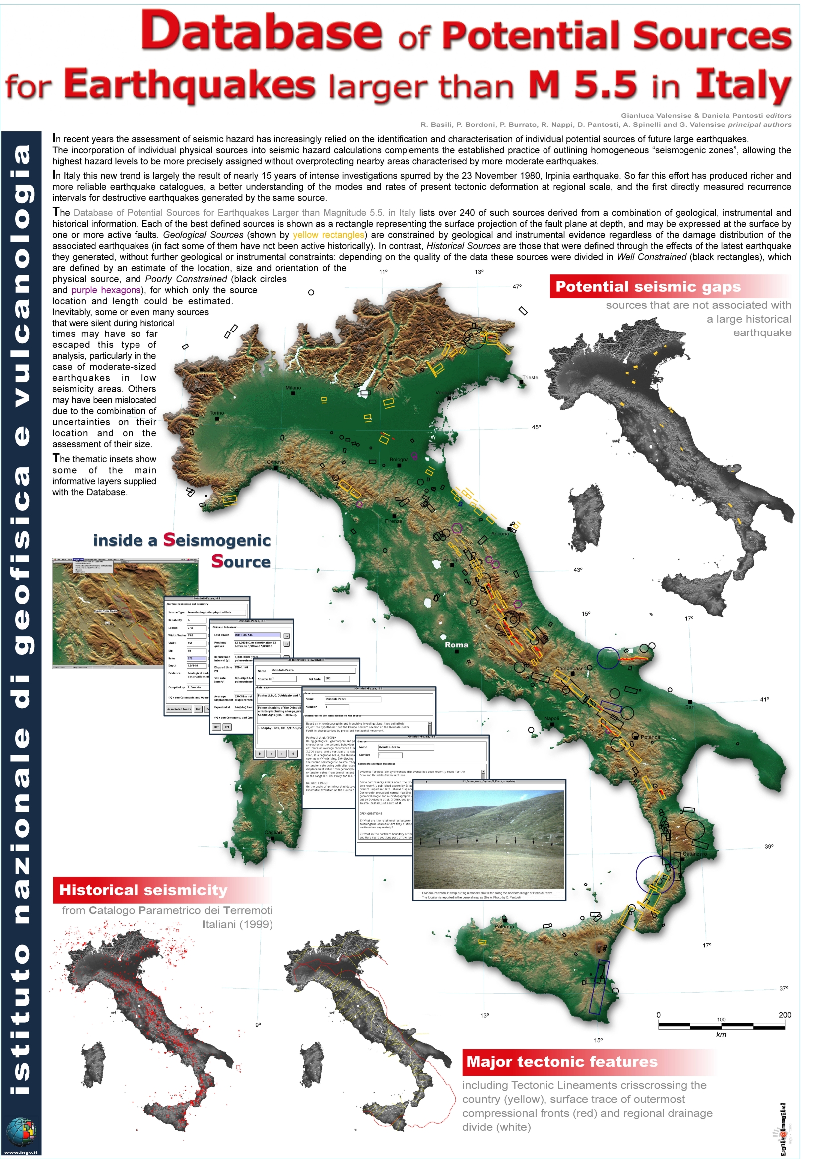
This version of the Database was the first to be expressly designed for widespread distribution to scientists, professionals and the general public. It was published in a special issue of Annals of Geophysics (Valensise and Pantosti, 2001). The volume included explanations on the database structure, an operating manual and the full database on a CD-ROM (read more and download...).

July 2000

DISS version 1.0

A standalone MapInfo® application released for circulation within INGV and a few selected institutions. DISS’ structure was developed jointly by INGV scientists and by IMteam, a software consulting firm based in Bergamo.

July 2000

INGV logo
DPC Logo
EPOS Italia logo